Outreach and Presentations
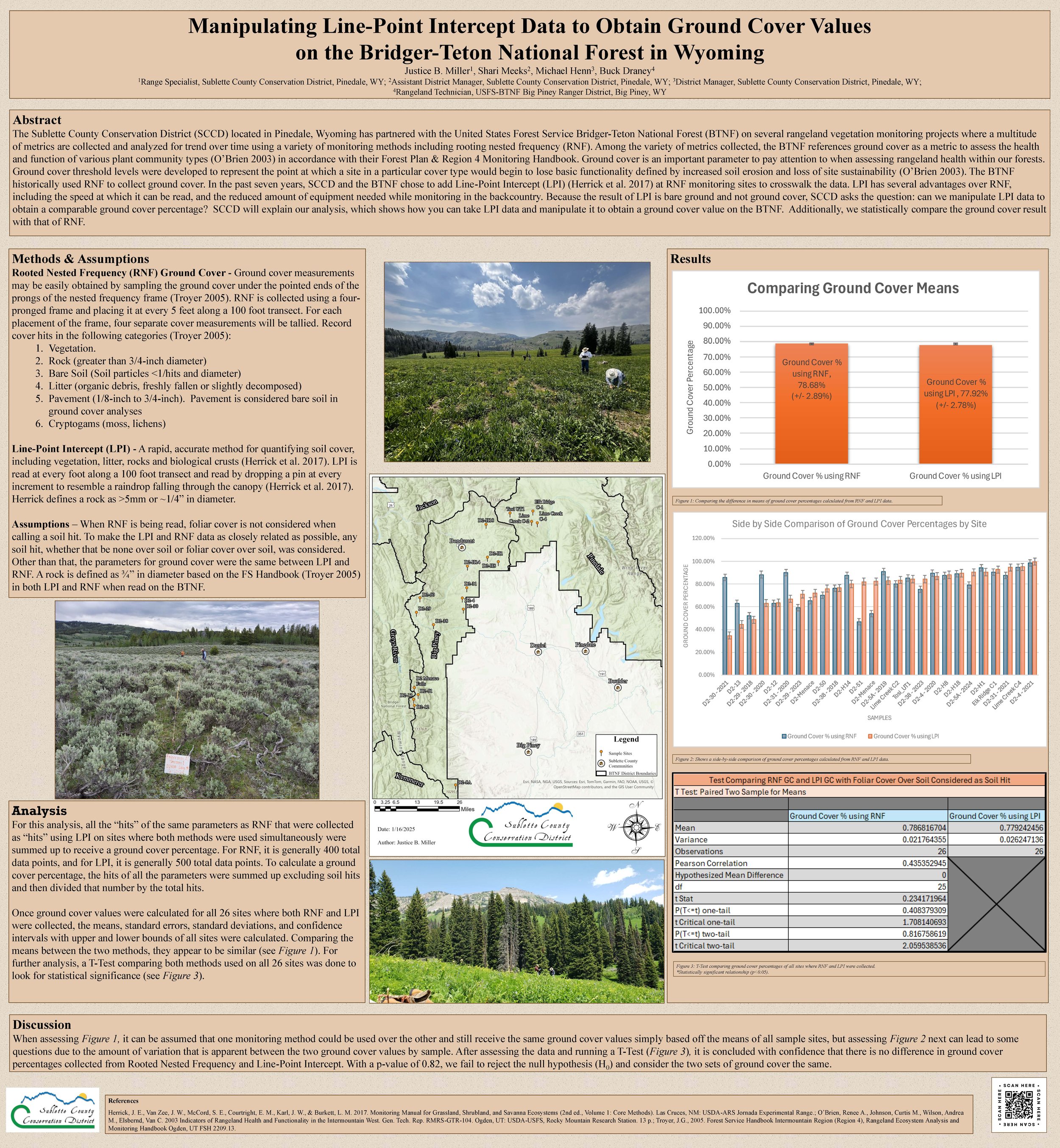
Manipulating Line-Point Intercept Data to Obtain Ground Cover Values on the Bridger-Teton National Forest in Wyoming

Cooperative Monitoring Promotes Healthy Rangelands While Building Relationships
Presented by: Keller Hyde, Range Specialist